As we face a day of lousy weather, I took our dog out for a walk early before Storm Darragh makes that a much less appealing option! On our walkies route is a new building site, where a long-term unused site is in the midst of being cleared and foundations created for two new buildings. The contractor has done a lot of work and a great job of those foundations over recent weeks, it’s incredible how many layers go into the foundations though before a brick is laid!
So the Insurance Broker in me (which never switches off, not even on a drizzly dog walk!) got me thinking about those foundations and what a huge deluge could do to them! I know, it won’t happen but us Brokers, however optimistic, have to consider the most pessimistic of scenarios…really bad stuff does happen! Possibly not as bad as that whole site sliding from the top of the hill into the Forth but you can see where my imagination was taking me!
However the purpose of this Blog post today was to share an online tool which is very useful. It’s probably a new site to most of you , however I wouldn’t think about buying a new home without checking it out first and it’s equally relevant to businesses purchasing or buying new premises.
Here is the link to the SEPA Flood Map site:
https://map.sepa.org.uk/floodmaps/FloodRisk/PostCode
Just plug in the postcode and you have three options: Rivers, Coastal and Surface Water, as below:
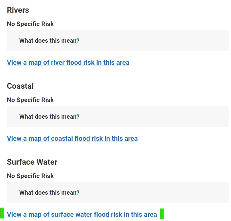
They are all useful, however the vast majority of us in Scotland don’t live close enough to the coast or a significant river to worry about those risks.
Surface Water though is a big concern. The weather clearly is getting worse, drainage isn’t coping with the greater volumes of water – and water is increasingly gathering…and causing significant flood damage.
Below is the map today of Dunfermline (chosen at random) which illustrates where (statistically) water is most likely to gather in the area:
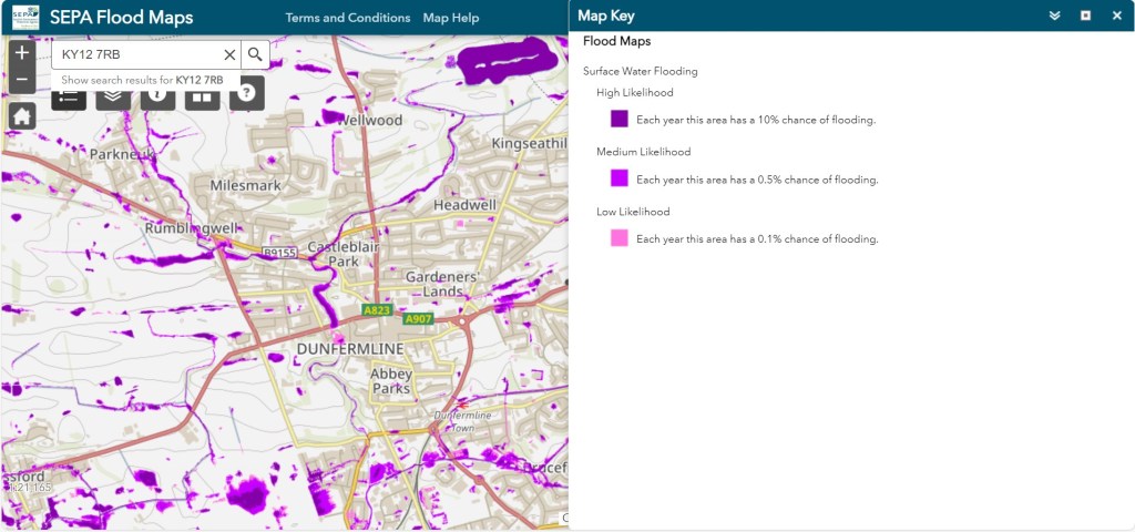
It is wise to highlight that this is the position today, the way the weather patterns are going, there will be parts of that map in a few years which are more deep purple than Smoke On The Water!
As you may have already guessed, Insurance Companies are using similar forecasting technology to determine premium rating for flood risk, another financial consideration to factor in beyond the disruption and inconvenience of a flood.
If this free research helps to make some more informed choices, it can only be a positive share.

Leave a comment